Lac Alajuela
| Lac Alajuela | |||
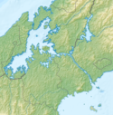
 Image satellite en couleurs réelles du lac |
|||
| Administration | |||
|---|---|---|---|
| Pays | Panama | ||
| Géographie | |||
| Coordonnées | 9° 15′ N, 79° 35′ O | ||
| Type | artificiel | ||
| Hydrographie | |||
| Émissaire(s) | Canal de Panama | ||
|
Géolocalisation sur la carte : Canal de Panama
Géolocalisation sur la carte : Panama
|
|||
| modifier |
|||
Le lac Alajuela est un lac artificiel relié au Canal de Panama, pour lequel il sert de réservoir.
Début , la surface du lac a atteint son plus haut niveau jamais enregistré, forçant la fermeture du canal de Panama pendant 17 heures[1].
Le Camino Real longe une partie du lac Alajuela.
Notes et références
- (en) « Lago Alajuela, Panama », NASA
Voir aussi
- le lac sur le site Earth observatory de la NASA
Médias utilisés sur cette page
Shiny blue button/marker widget.
Icon for a river delta
Auteur/Créateur: OldBee, Licence: CC BY-SA 4.0
Topographic map of the Panama Canal (blank)
Auteur/Créateur: Christian Strassnig, Licence: CC BY-SA 3.0
Cobble of the Camino Real close the shore of Alajuela Lake. Every dry seasons the level of the lake falls considerably because it provides water for the Panama Canal. Hence, flooded sections of the Camino Real reappear.
Auteur/Créateur: Alexrk2, Licence: CC BY-SA 3.0
Physical location map of Panama
Equirectangular projection. Geographic limits of the map:
- N: 10.28° N
- S: 6.79° N
- W: 83.56° W
- O: 76.64° W
Natural-colour image of Lago Alajuela. This image has been rotated so north is to the right. The Panama Canal lies off the top left corner of the image. Torrential rains can erode soils, delivering heavy sediment loads to streams, rivers, and lakes. Ranging in colour from dull green to tan, Lago Alajuela appears choked with sediment, contrasting sharply with the surrounding green forest.


